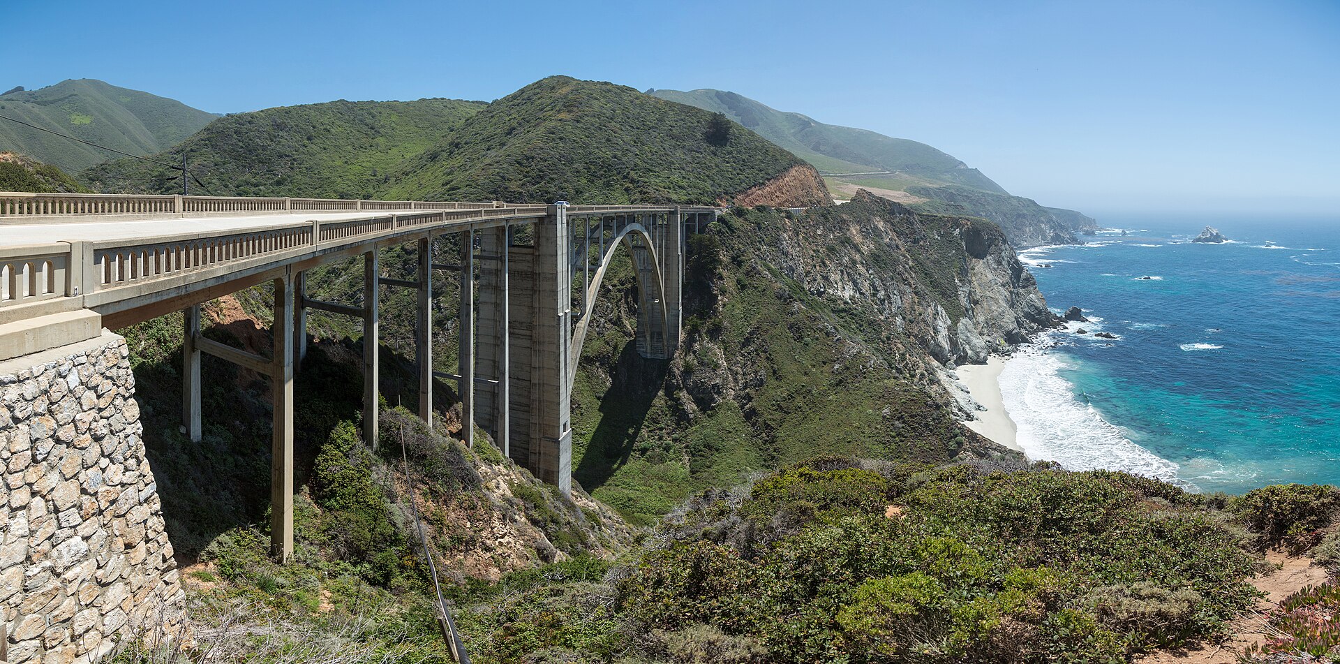
California’s Highway 1 through Big Sur is best enjoyed as a slow coastal drive, not a checklist of viewpoints. Plan around a few priority stops, leave time for short walks and meals, and confirm that the sections you intend to drive are open on your travel dates. Coastal access can change after storms, landslides and road work.
Plan the route before choosing stops
Decide whether you will approach from the Monterey/Carmel side or from the south, then group stops by the stretch of road you can safely reach. Do not assume a route is continuous because an older guide or map shows it that way. Check current Highway 1 conditions with Caltrans before leaving and again if weather changes.
NEXT ON THE TRAILRedwood Country: A First-Timer’s Guide to California’s Giant Trees
Build a flexible day
| Trip style | How to plan it | What to protect time for |
|---|---|---|
| Scenic weekend | Choose a small number of coastal viewpoints and one or two short walks. | Parking, slow driving, meals and unplanned stops. |
| Hiking-focused | Choose fewer viewpoints and reserve meaningful time for one confirmed-open trail. | Trail access, weather, daylight and return time. |
| Photography trip | Plan around light and stay flexible about the order of stops. | Safe pullouts and extra time at viewpoints. |
| Family trip | Use shorter activity blocks and avoid a tightly timed schedule. | Restrooms, food, breaks and changing conditions. |
Choose coastal stops carefully
Big Sur is more than a sequence of photo stops. A combination of coastal overlooks, beaches where access is open, and forest walks can give the trip variety. Confirm current access, parking rules and trail status from the responsible land manager before committing to a stop. Never enter a closed area or stop where parking is prohibited or unsafe.
Do not overpack the driving day
A viewpoint that looks close on a map can take longer than expected once slow coastal driving, parking, walking and photographs are included. Pick your must-see stops first and treat everything else as optional. Build in unplanned time rather than scheduling every stop to the minute.
Keep a backup route
If a planned stretch is closed, do not rely on an unofficial detour or assume the closure will clear. Rebuild the day around the confirmed-open section, choose another suitable destination, or change the overnight plan. If a closure makes the intended route impractical, postpone that segment rather than taking risks on unfamiliar roads.
Driving and coastal safety
- Check official road conditions immediately before departure and during the trip if conditions change.
- Follow posted speed limits, warning signs and closure barriers.
- Use designated pullouts; do not stop in traffic lanes or on unsafe shoulders.
- Keep distance from cliff edges, unstable bluffs and surf zones.
- Carry water, snacks, layers, a charged phone and offline navigation.
- Allow extra time for slow driving, parking and limited services in remote stretches.
Where to verify current information
Start with Caltrans QuickMap and road conditions for current closures and incidents. For local visitor information and access notes, consult the Big Sur Chamber of Commerce visitor resources. Check official land-manager pages for any specific beach, trail or park you plan to visit; access rules differ by location.
Information checked: October 2026. Road conditions, access and services can change; verify them again for your travel dates.
Written & researched by Graham Grey
Graham Grey is the founder of Wild Trail Atlas and conducts research for its travel guides. Guides distinguish firsthand experience from independently researched information and should be checked against relevant primary or official sources where available.
Final thoughts
A memorable Big Sur day often includes fewer destinations than expected. Choose a manageable stretch of coast, leave time to walk and pause, and let current road conditions shape the final itinerary. Flexibility is part of a safer and more rewarding Highway 1 trip.
More from Wild Trail Atlas