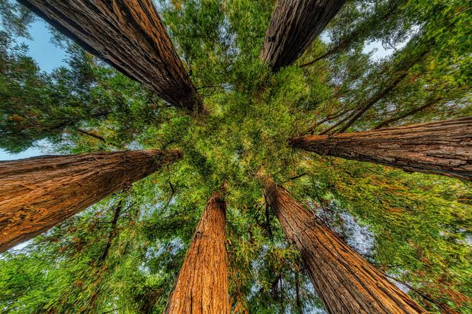
California’s redwood country is not one drive-up attraction. The redwood groves, beaches, prairies and river valleys of Redwood National and State Parks cover a wide area of the North Coast, so a satisfying first visit starts by choosing one area and a few walks rather than trying to see everything in a day.
NEXT ON THE TRAILCalifornia Highway 1 to Big Sur: A Scenic Road Trip Guide
Use this guide to choose a walk that matches your time, build a realistic route and check access before you set out. Distances and difficulty below follow the official park trail information; time estimates are planning allowances, not official trail times.
Key Details at a Glance
| Half day | choose one short redwood walk such as Circle Trail, then add a scenic drive and visitor-center stop if time allows. |
|---|---|
| Full day | choose one medium walk such as Cathedral Trees, add one nearby scenic stop and leave slack for slow driving and parking. |
| Two or more days | split the region into geographic clusters—forest and prairie on one day, then a coastal or river area on another. Choose a longer hike only when your group has the time, footwear and energy to enjoy the return journey. |
Build a route around one area
Start with Prairie Creek Redwoods State Park if old-growth forest walks are your priority. Big Tree Wayside and the Cathedral Trees area offer short and medium-length options, while the longer creek and ridge trails suit visitors who want more time on foot. A scenic drive along Newton B. Drury Scenic Parkway can connect forest stops without turning the day into a long checklist.
Keep beaches and remote coastal stops for another cluster of the trip. Distances on the map can be misleading on winding North Coast roads, and a trailhead in one part of the parks may not be a quick hop from another. Plan by area, not by the number of pins you can fit into a day.
Know the access and parking details
- Use the exact trailhead directions. The official listings identify access points along Newton B. Drury Scenic Parkway and other park roads. Save the relevant map before driving; mobile coverage should not be your only navigation plan.
- Allow for limited parking. Some trailheads and waysides have limited spaces, especially for larger vehicles. Do not assume every trail has a large lot or room for an RV.
- Check Fern Canyon separately. Its access road, wet footing and seasonal bridges make it different from a short wayside walk. For 2026, the park lists a day-use reservation period of May 15–September 15; rules and dates can change, so check the current park conditions and reservation instructions for your travel year.
- Recheck roads and closures. Rain, fallen trees, fire activity or maintenance can alter the route. Start at the official Redwood National and State Parks planning page and open current conditions on the day before travel.
When to go and what to pack
The forest is green and atmospheric in many kinds of weather, but damp ground, fog and rain can affect footing and visibility. Spring and early summer can bring lush growth and seasonal blooms on selected trails; coastal weather can still change quickly. Check the forecast for the precise area you will visit rather than relying only on a forecast for a nearby town.
Wear shoes with reliable grip, bring a waterproof layer, water and snacks, and carry a paper or offline map. On longer routes, note the elevation and the return distance before starting. Keep a comfortable buffer for photos and pauses, and turn around if the trail or weather is worse than expected.
Before You Go
- Check the current official access and conditions information before departure.
- Confirm seasonal closures, permits, reservations and transportation requirements that may apply.
- Build extra time into the day for parking, weather, road conditions and unexpected delays.
- Use the guide as a planning framework and verify time-sensitive details with the responsible land manager or official destination source.
- Treat driving times as planning estimates rather than guarantees, especially on scenic or mountain routes.
WILD TRAIL ATLAS • PRACTICAL PLANNING
Redwood Country: Route choices and access map
Use this comparison to pick a walk that fits your group. Trail distances and difficulty follow the park’s trail listings; time ranges described as planning estimates are not official trail times.
Initial source review: October 6, 2026. Conditions and operating rules change; check the linked official source again for your travel dates.
Map of destination and trailhead areas
Area pins only — these are not surveyed hiking lines. Use the official park map and current directions for the precise trailhead.
Interactive map loading. The links below remain available if the map service is unavailable.
Compare named routes
| Trail / destination | Distance | Time guide | Effort / climb | Access notes and source |
|---|---|---|---|---|
| Circle Trail at Big Tree Wayside Very short forest walk Open map search ↗ | 0.2 mile loop | About 10–20 min (planning estimate) | Easy Not published in the cited trail entry | Marked trail at Big Tree Wayside; parking is limited. Official details ↗ |
| Cathedral Trees Trail A longer old-growth forest walk Open map search ↗ | 1.4 miles listed by the park | About 45–75 min (planning estimate) | Moderate Not published in the cited trail entry | Trail access is linked to the Big Tree Wayside area; check the official map for the connection you plan to use. Official details ↗ |
| Ten Taypo–Hope Creek Loop A substantial creek and old-growth forest hike Open map search ↗ | 4-mile loop | About 2–3 hours (planning estimate) | Moderate; some steep grades Not published in the cited trail entry | Trailhead is off Newton B. Drury Scenic Parkway; the park notes limited parking for larger vehicles. Official details ↗ |
| Fern Canyon Loop Fern-lined canyon scenery Open map search ↗ | 0.7-mile loop | About 30–60 min (planning estimate; access adds time) | Uneven, non-level grades Not published in the cited trail entry | Feet may get wet; seasonal bridges and reservations may apply. Check current rules and road conditions before driving Davison Road. Official details ↗ |
Elevation comparison where official figures are available
Verified elevation-gain figures are not available for enough routes to compare here. The Route Library supports genuine elevation-profile charts when a track profile is entered; this page will not invent a trail profile.
Parking and access sequence
Planning schematic only, not a to-scale parking map. Check the official map and parking signs at arrival.
Estimate a hiking time budget
Enter the full planned distance, including the return. This is a flexible planning heuristic, not a route-specific or official time estimate.
The estimate uses your chosen walking pace plus a simple ascent allowance. It does not know trail surface, switchbacks, crowding, heat, snow, route-finding or fitness. Use the land manager’s trail information first and add a generous safety buffer.
Official sources to recheck before departure
The pins show a general trail area, not a surveyed hiking line. Distances, access points and reservation rules can change; confirm the current park map before departure.
Final thoughts
Redwood country rewards a slower itinerary, but slow travel still benefits from specific choices. Pick one forest area, choose a walk whose distance and terrain suit your group, and verify access and parking before leaving. A small number of well-chosen stops will usually make a more memorable first visit than rushing between distant trailheads.
More from Wild Trail Atlas