At a glance: What to know before visiting
| Location | Tennessee and North Carolina |
|---|---|
| Park size | Approximately 522,000 acres |
| Best known for | Mountains, waterfalls, forests, wildlife and scenic drives |
| Entrance fee | No general entrance fee |
| Parking tag | $5 daily, $15 weekly, $40 annual (verify current rates before travel) |
| Opening | Open year-round; individual roads and facilities close seasonally |
| Main access areas | Gatlinburg, Townsend and Cherokee |
| Recommended visit | Two to three days for a first visit |
Where is Great Smoky Mountains National Park?
Great Smoky Mountains National Park sits along the Tennessee–North Carolina border in the southern Appalachian Mountains. Gatlinburg is a useful base for Sugarlands, Newfound Gap, Kuwohi and Roaring Fork. Townsend provides access to Cades Cove and the western side of the park. Cherokee is convenient for Oconaluftee, Mingus Mill and southern park areas. Knoxville and Asheville are useful regional travel hubs.
These entrances serve different parts of the park. Driving from Gatlinburg to Cades Cove, for example, takes a different route from visiting Oconaluftee near Cherokee. Choose accommodation with your intended stops in mind and check a current park map before setting out.
15 best things to do in Great Smoky Mountains National Park
1. Explore Cades Cove and its historic mountain community
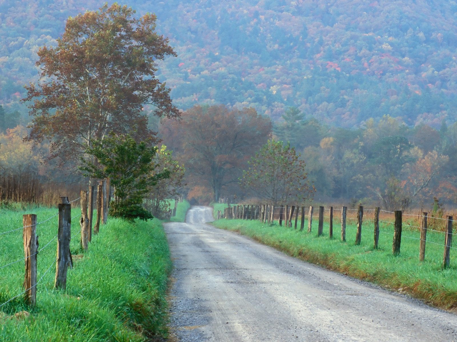
Cades Cove is a broad valley surrounded by mountains, with open meadows, wooded hillsides, historic buildings and opportunities to watch wildlife. The 11-mile, one-way Cades Cove Loop Road passes historic cabins, churches, cemeteries and old farm buildings that help tell the story of Appalachian communities before the park was established.
Make time for the Cable Mill Historic Area and its visitor center. White-tailed deer are often seen in the valley; black bears and wild turkeys may also appear. Wildlife sightings are never guaranteed, so enjoy the landscape rather than approaching animals.
- Allow at least 2–4 hours for the loop, longer if you hike.
- The loop is one-way; plan stops before entering.
- Traffic is often heavy in summer, autumn and on weekends.
- Use paved pullouts rather than stopping in the road.
- Vehicle-free Wednesdays operate during a published seasonal period; verify the current year’s dates.
Location: Near Townsend, Tennessee. Best for: Scenic driving, wildlife watching, photography and history.
2. Climb to Kuwohi Observation Tower for sweeping mountain views
At 6,643 feet, Kuwohi is the highest point in Great Smoky Mountains National Park. Formerly known as Clingmans Dome, the mountain’s Cherokee name was restored in 2024. On a clear day, ridges stretch in every direction from the summit observation tower.
A paved half-mile trail climbs steeply from the parking area to the tower. The distance is short, but the grade and elevation can make it strenuous. Take your time and bring a warm layer: summit conditions can be much colder and windier than the valleys.
- Approximately 1 mile round trip.
- Short but steep paved walk.
- Elevation: 6,643 feet.
- Kuwohi Road normally closes in winter, generally December 1 through March 31; confirm dates and conditions.
- Clouds can obscure the view, so check the forecast.
Location: Off Newfound Gap Road. Best for: Panoramic views and photography.
3. Drive Newfound Gap Road through the heart of the Smokies
US-441, also known as Newfound Gap Road, crosses the park between Gatlinburg, Tennessee, and Cherokee, North Carolina. The drive climbs through changing forest types and mountain elevations, with overlooks along the way. Stop at Newfound Gap, where the Appalachian Trail crosses the road and the Tennessee–North Carolina state line runs through the parking area.
- Allow extra time for viewpoints and traffic.
- Higher elevations can be significantly colder.
- Winter weather can cause temporary closures.
- Check NPS road alerts before departure.
Best for: Scenic driving, mountain views and visitors who prefer short walks to long hikes.
4. Walk through the forest to Grotto Falls
Grotto Falls is unusual because the trail passes behind the falling water. The route follows Trillium Gap Trail from the trailhead along Roaring Fork Motor Nature Trail, winding through a cool forest before reaching the 25-foot waterfall.
- Approximately 2.6 miles round trip.
- Moderate difficulty; allow roughly 1.5–2 hours.
- The path can be muddy, rocky and slippery after rain.
- Trailhead parking is limited and fills early.
- Check current trail conditions and access before leaving.
Location: Roaring Fork area near Gatlinburg. Best for: Waterfall photography and moderate hiking.
5. Discover the historic buildings along Roaring Fork Motor Nature Trail
This narrow, one-way scenic loop winds through forest, mountain streams and preserved Appalachian buildings. The Noah “Bud” Ogle Self-Guiding Nature Trail near the entrance offers a look at an old mountain farmstead. The route is a good choice for visitors who want a mixture of short walks, history and scenery.
- The motor nature trail is approximately 5.5 miles.
- Allow extra time for stops and walks.
- The road is narrow and one-way.
- It closes seasonally, generally during winter.
- Rainbow Falls Trail is accessed from this area but is a substantially longer hike.
Location: Near Gatlinburg. Best for: Historic buildings, streams and scenic driving.
6. Hike to Abrams Falls in the heart of Cades Cove
Abrams Falls is about 25 feet high, but its strong flow and deep pool make it one of the park’s best-known waterfalls. The trail passes through forest before reaching the rocky viewing area. The sound of the water grows louder as you approach.
- Approximately 5 miles round trip.
- Moderate hike with uneven and rocky sections.
- Allow approximately 3–4 hours.
- The trailhead is along Cades Cove Loop Road.
- Swimming is dangerous because of strong currents and undertows; stay out of the water.
Location: Cades Cove. Best for: Waterfall enthusiasts and moderately experienced hikers.
7. Visit Deep Creek and discover three waterfalls
Near Bryson City, North Carolina, Deep Creek offers streamside trails and several waterfall routes. The popular Waterfalls Loop links Tom Branch Falls, Indian Creek Falls and Juney Whank Falls. It is a rewarding way to see several different cascades without committing to a full-day hike.
- The waterfalls loop is approximately 2.4 miles.
- Expect uneven and sometimes rocky sections.
- A shorter route to Indian Creek Falls is also available.
- Wear shoes with good grip and avoid fast-moving water, especially after heavy rain.
Location: Deep Creek area near Bryson City, North Carolina. Best for: Waterfall lovers and relaxed outdoor exploration.
8. Watch wild elk in the Oconaluftee Valley
Oconaluftee, near the Cherokee entrance, is one of the park’s main places to look for elk. Animals are often seen grazing in open fields, particularly in the early morning and evening. Autumn is the rutting season, when male elk may bugle and compete for females.
- Bring binoculars if you have them.
- Never approach, feed or surround elk.
- Remain at a safe distance and follow posted wildlife guidance.
- Wildlife sightings are not guaranteed.
Location: Near Cherokee, North Carolina. Best for: Wildlife watching and photography.
9. Explore the Mountain Farm Museum
Beside the Oconaluftee Visitor Center, the Mountain Farm Museum preserves historic Appalachian farm buildings, including a farmhouse, barn, smokehouse and applehouse. Walking around the structures offers a glimpse of how families lived and worked in the mountain communities before the park was established.
- Allow approximately 30–60 minutes.
- Combine the visit with elk watching in the valley.
- Check visitor-center hours and seasonal access.
Best for: History, education and families.
10. Stop at Sugarlands Visitor Center before exploring
Sugarlands Visitor Center, about two miles south of Gatlinburg on Newfound Gap Road, is a practical first stop. Park staff can help with maps, current conditions and choosing suitable activities. Exhibits introduce the park’s natural and cultural history.
- Allow 30–60 minutes.
- Ask about current road and trail closures.
- Visitor-center hours vary by season.
Best for: First-time visitors and trip planning.
11. Enjoy the scenery along Little River Road
Little River Road follows the river through forested valleys and connects the Sugarlands area with the Townsend side of the park. It offers a closer look at the streams and wooded landscapes that define the Smokies. Use designated pullouts and watch for pedestrians and cyclists.
Best for: Scenic driving, river views and relaxed exploration.
12. Cycle Cades Cove on a vehicle-free day
Cades Cove’s 11-mile loop can be especially peaceful by bicycle. During the published seasonal vehicle-free Wednesdays, motor vehicles are prohibited on the loop, creating an opportunity for cyclists and pedestrians to enjoy the valley without regular vehicle traffic.
- The loop is approximately 11 miles.
- Allow several hours, depending on pace and stops.
- Check the official schedule for the current year’s vehicle-free dates.
- Wear a helmet, carry water and share the road responsibly.
Best for: Cycling, photography and outdoor recreation.
13. Discover historic Mingus Mill
Built in 1886 near the Cherokee entrance, Mingus Mill used a water-powered turbine to grind corn and wheat for nearby communities. Its wooden structure and water flume make it a worthwhile stop, especially when demonstrations are operating. Combine it with Oconaluftee and the Mountain Farm Museum.
- Allow approximately 20–40 minutes.
- Demonstrations and access may be seasonal.
- Check current operating information before visiting.
Best for: History, photography and cultural exploration.
14. Explore Cataloochee Valley and its historic settlements
Cataloochee is a quieter, more remote valley known for historic buildings, mountain scenery and elk. Old churches and homes tell the story of communities that once lived here. The access roads can be narrow, steep or unpaved, so check conditions and allow extra driving time. Services are limited; bring supplies.
Best for: Wildlife, history and visitors seeking a quieter area.
15. Enjoy a picnic beside the mountain streams
Not every memorable experience needs a long hike. Designated picnic areas around Cades Cove, Deep Creek and Metcalf Bottoms provide places to rest beside the water and enjoy the landscape. Pack out rubbish, secure food and never leave it unattended around wildlife. Check seasonal facility availability.
Best for: Families, couples and relaxed outdoor time.
Best time to visit Great Smoky Mountains National Park
The park is open throughout the year, but each season offers a different experience.
Spring (March–May)
Spring is a good time for wildflowers, stream walks and lower-elevation hikes. Rain can make trails muddy, and higher elevations may remain cold.
Summer (June–August)
Summer brings lush forests, warm weather and long days. It is popular for families, camping and waterfall visits. Expect heavier traffic around Gatlinburg, Cades Cove and popular trailheads. Afternoon thunderstorms are possible.
Autumn (September–November)
Autumn brings colourful foliage, scenic drives and good wildlife-watching opportunities. Higher elevations generally change colour before lower valleys. Traffic increases during peak foliage weekends.
Winter (December–February)
Winter can bring snow and quieter trails, but secondary roads and facilities close seasonally. Ice and rapidly changing weather can make mountain travel difficult. Check closures before setting out.
For a first visit, consider late September through October if fall colour is your priority. Late spring and early summer are also appealing for hiking and waterfalls. Actual conditions vary each year.
How to plan a 3-day Great Smoky Mountains itinerary
Day 1 — Gatlinburg, mountain viewpoints and waterfalls
- 8:00 AM — Sugarlands Visitor Center: Pick up maps and check closures.
- 9:00 AM — Newfound Gap: Enjoy the mountain views and state-line overlook.
- 10:30 AM — Kuwohi: Walk to the observation tower if the road is open and weather allows.
- 1:00 PM — Lunch and rest: Take a break before returning toward Gatlinburg.
- 2:30 PM — Roaring Fork Motor Nature Trail: Explore historic buildings and streams if seasonally open.
- Later afternoon — Grotto Falls: Add the hike only if time, parking and trail conditions allow.
Day 2 — Cades Cove and its historic landscape
- 8:00 AM — Arrive at Cades Cove: An early start leaves more time before traffic builds.
- 9:00 AM — Cades Cove Loop Road: Stop at historic cabins, churches and viewpoints.
- 11:00 AM — Cable Mill Historic Area: Explore the historic buildings.
- 12:30 PM — Lunch: Take a break at a designated picnic area.
- 1:30 PM — Abrams Falls: Set aside roughly 3–4 hours for the round-trip hike, if conditions and fitness allow.
- Evening: Return to your accommodation, allowing for traffic.
Day 3 — Cherokee, waterfalls and Appalachian history
- 8:00 AM — Oconaluftee Valley: Look for elk from a safe distance.
- 9:30 AM — Mountain Farm Museum: Explore historic Appalachian buildings.
- 10:30 AM — Mingus Mill: Learn about water-powered milling.
- 12:00 PM — Deep Creek: Head toward Bryson City for lunch and waterfall walks.
- 1:30 PM — Deep Creek Waterfalls Loop: Walk the approximately 2.4-mile route, allowing time for stops.
- Afternoon: Return to Cherokee or your accommodation.
This is a suggested route, not a guarantee of current access. Check NPS alerts each day. Driving times depend on traffic, weather and road conditions.
Where to stay when visiting Great Smoky Mountains National Park
Gatlinburg, Tennessee
A convenient base for Sugarlands, Newfound Gap, Kuwohi and Roaring Fork. It has restaurants, shops and a wide range of accommodation.
Townsend, Tennessee
A quieter option for visitors concentrating on Cades Cove, the western park entrance and Little River.
Cherokee, North Carolina
A useful base for Oconaluftee, Mingus Mill and the southern park areas.
Inside the national park
Park campgrounds offer a more immersive experience. Facilities, opening dates and reservation requirements vary. Check the official park camping pages and Recreation.gov before booking.
How much does it cost to visit Great Smoky Mountains National Park?
There is no general entrance fee. However, a parking tag is required when parking inside park boundaries for more than 15 minutes. The published rates are $5 daily, $15 weekly and $40 annually; verify current prices before travel.
- Each tag is valid for one vehicle.
- Physical tags must be displayed in the vehicle.
- A tag does not guarantee a parking space.
- America the Beautiful passes do not replace the Smokies parking tag.
Other expenses may include accommodation, food, fuel, campground reservations and equipment rentals. Packing food and choosing accommodation near your planned activities can help control costs.
Important things to know before your first visit
Check road and trail closures
Weather, maintenance and seasonal conditions affect access. Laurel Falls Trail has been closed for rehabilitation, with reopening anticipated in 2027; do not plan to hike it unless NPS confirms it has reopened. Check the official current conditions page immediately before travelling.
Don’t depend on mobile phone reception
Cell service is unavailable in many parts of the park, including Cades Cove and Cataloochee. Download offline maps, save directions and keep accommodation details available before leaving town.
Be careful around black bears
Black bears live throughout the Smokies. Never approach or feed a bear, secure food and rubbish, and follow park wildlife guidance. Keep a safe distance from all wildlife.
Prepare for changing mountain weather
Temperatures can vary substantially between lower valleys and high elevations. Carry an extra layer and rain protection, wear suitable footwear and check the forecast before hiking.
Choose hikes that match your ability
A short trail is not automatically easy. Steep climbs, slippery rocks, stream crossings and weather can make a route challenging. Check the distance, elevation gain and current trail conditions before starting.
Understand pet restrictions
Pets are prohibited on most park hiking trails. The Gatlinburg Trail and Oconaluftee River Trail are the two exceptions. Pets are also allowed in designated picnic areas, campgrounds and along roads, subject to park rules.
Carry water and essential supplies
For longer hikes, bring drinking water, food, navigation equipment, a first-aid kit and weather-appropriate clothing. Do not assume every trailhead has drinking water or facilities.
Frequently asked questions
Is Great Smoky Mountains National Park worth visiting?
Yes. It combines scenic mountain drives, waterfalls, hiking trails, historic communities and wildlife viewing. Visitors who prefer not to hike can still enjoy plenty of overlooks and historic sites.
How many days do you need?
Two to three days is a good starting point. Three days allows time for Cades Cove, Kuwohi, Oconaluftee and Deep Creek without rushing.
Is the park free?
There is no entrance fee, but vehicles parked for more than 15 minutes need a valid parking tag. Check current prices and rules before travelling.
Can you see black bears?
Black bears live throughout the park, but sightings are never guaranteed. Observe from a safe distance and never feed or approach them.
What is the most beautiful part of the park?
It depends on what you enjoy. Cades Cove has open valleys and historic buildings, Kuwohi offers panoramic mountain views, and Deep Creek is known for waterfalls.
Can you visit in winter?
Yes. The park remains open, but some secondary roads and facilities close seasonally. Check road conditions before travelling.
Is the park suitable for beginners?
Yes. Scenic drives, visitor centers, historic sites and shorter walks offer plenty to do without attempting difficult hikes. Choose trails that match your fitness and experience.
Final thoughts: Give yourself time to experience the Smokies
Your first visit does not have to be about collecting photographs of every famous attraction. Some of the best memories may come from watching elk move through a meadow, hearing a waterfall before you see it, discovering an old mountain cabin or standing above the clouds at Kuwohi.
Leave room for unexpected stops and don’t squeeze too many destinations into one day. Use three days to explore different parts of the park: mountain viewpoints and waterfalls, the historic landscape of Cades Cove, and the quieter areas around Cherokee and Deep Creek.
The Smokies have a way of making you appreciate the journey just as much as the destination. And that is a good reason to return.
Official sources and further trip-planning resources
- Great Smoky Mountains National Park — official website
- Current road and trail conditions
- Official hiking information and safety
- Cades Cove visitor information
- Parking tags and fees
- Operating hours and seasonal closures
- Deep Creek visitor information
- Oconaluftee visitor information
Editorial note: This is a research-based visitor guide, not a claim of firsthand travel experience. Conditions, fees, schedules and closures can change. Verify details with the National Park Service before travelling.
About Wild Trail Atlas
Wild Trail Atlas creates practical outdoor travel guides to help readers plan hikes, national park visits, scenic drives and nature trips. Our editorial team uses official park information and other reliable sources to explain routes, visitor requirements, seasonal considerations and planning details. We review time-sensitive information and encourage readers to confirm current conditions with the relevant land manager before setting out.
More from Wild Trail Atlas